
Start at Polače or Pomena for the National Park, choose a north-coast pickup for the bays around Sobra and Okuklje, or head east for the sandy shore at Saplunara. Mljet’s outer coast and protected western waters call for different plans. Choose a departure point close to the stretch you want to explore and agree the route with the boat owner.
Mljet Island – Choose pickup
Choose your departure place, then set your dates in FINDER.
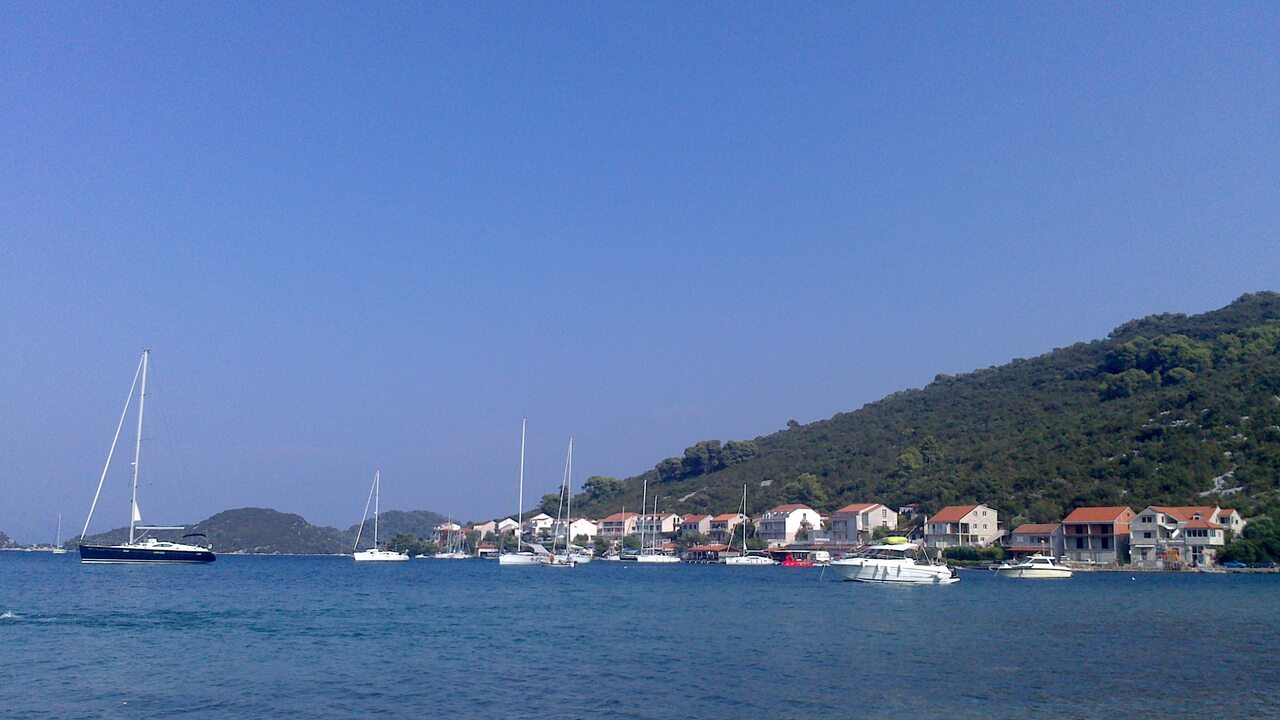
Polače, Pomena and the western end
Polače sits at the head of a long bay screened by several islets, including Tajnik, Kobrava and Moračnik. The ruins of a late Roman palace stand beside the village waterfront. Allow time to see them on foot and confirm the exact meeting point with the owner, especially when the pickup is listed as Marina Polače.
Pomena lies near Mljet’s northwestern tip and is another National Park entrance. From the village, continue ashore towards Malo Jezero and Veliko Jezero, the park’s saltwater lakes. On Veliko Jezero, the park’s passenger boat serves St Mary’s islet and its Benedictine monastery. Check the current schedule before planning a stop.
Boating in Mljet National Park
- Arrange permission for the boat. Visitor vessels need the park’s navigation permission, obtained with a paid vessel ticket. The charge depends on boat length and the length of the visit. Confirm the ticket and its coverage with the park and the owner before entering.
- Observe the coastal speed limit. In park waters, the maximum is 5 knots within 150 metres of the shore. Follow the park’s signs and any local harbour directions.
- Use the designated berthing and anchoring areas. The park publishes permitted waters at Pomena, including parts of the Lokva area, and Polače. Anchoring is prohibited in zone IIc, and both berthing and anchoring are prohibited at sites including Gonoturska and the Vratosolina passage. Check the park’s current zone map and instructions before dropping anchor, and keep the anchor clear of seagrass.
- Visit the lakes ashore. Keep rental motorboats outside the Soline Channel and both lakes. Use the park’s authorised visitor transport for St Mary’s. Fishing in park waters requires a park licence and is limited to permitted areas.
North-coast harbours and the eastern and southern shores
Kozarica and Sobra
Kozarica is a small coastal village east of the park. Sobra opens onto the Mljet Channel and receives the car ferry from Prapratno on Pelješac. If arriving by ferry, confirm where the rental handover takes place and how to reach it. Keep the ferry’s approach and manoeuvring area clear. Check the forecast for the channel before leaving either pickup.
Prožurska Luka and Okuklje
Prožurska Luka is the waterfront settlement below Prožura. If you select Prožura in FINDER, ask the owner for the precise coastal meeting point. Further east, Okuklje sits at the head of an enclosed inlet. Confirm visitor berthing with its operator and check the approach on an up-to-date chart.
Saplunara and Limuni
Saplunara’s sandy bay and nearby Limuni, also called Blace, lie near the island’s southeastern end. Saplunara is a protected landscape. Check the local instructions before anchoring or going ashore, and leave marked swimming areas clear of boats. Carry a return plan that takes wind and sea conditions around the eastern tip into account.
Sutmiholjska and Odysseus Cave
Sutmiholjska is a separate cove on the outer coast. Near Babino Polje, Odysseus Cave opens to the sea through a narrow rock passage. Swell makes that entrance unsuitable for a water visit. Keep the rental boat outside the cave, allow room for swimmers and ask locally about conditions or the approach from land.
Before you set out
- Agree the route and handover. Check the permitted cruising area, skipper or licence requirements, boat capacity, fuel arrangements and return time with the owner.
- Check the forecast for the return leg. Use the Adriatic marine forecast, current nautical charts and port notices. Choose a shorter route if the outer coast or the Mljet Channel is likely to be rough.
- Confirm each stop locally. Check berth availability, permission to anchor and any marked bathing or conservation zones. Keep wastewater, oil and rubbish aboard in the park and use designated disposal facilities.
Local guide sources
- Mljet National Park boating rules, zones and anchoring
- Mljet National Park visitor information and lake access
- Mljet National Park archaeological sites at Polače
- Mljet National Park history of St Mary’s islet
- Mljet National Park island settlements and the Saplunara protected landscape
- Mljet Tourist Board sailing areas and harbours
- Mljet Tourist Board Odysseus Cave
- Jadrolinija Prapratno–Sobra ferry
- DHMZ Adriatic marine forecast
- Hydrographic Institute of Croatia Notices to Mariners
- Polace, Ile de Mljet, Croatie.jpg by Boooom, licensed under CC BY-SA 3.0. Resized and compressed for this guide.
