
Pašman invites two different kinds of boat day: a gentle outing among the channel’s waterfront villages and islets, or a more committed trip to the bays of the southwestern coast. Begin with the departure place, the boat and the forecast. A harbour lunch, an unhurried swim or a view across the outer islands can each be enough reason to spend the day afloat.
Pašman Island – Choose pickup
Choose a pickup place, then set your dates in Finder.
Pašman village: a waterfront base on the channel
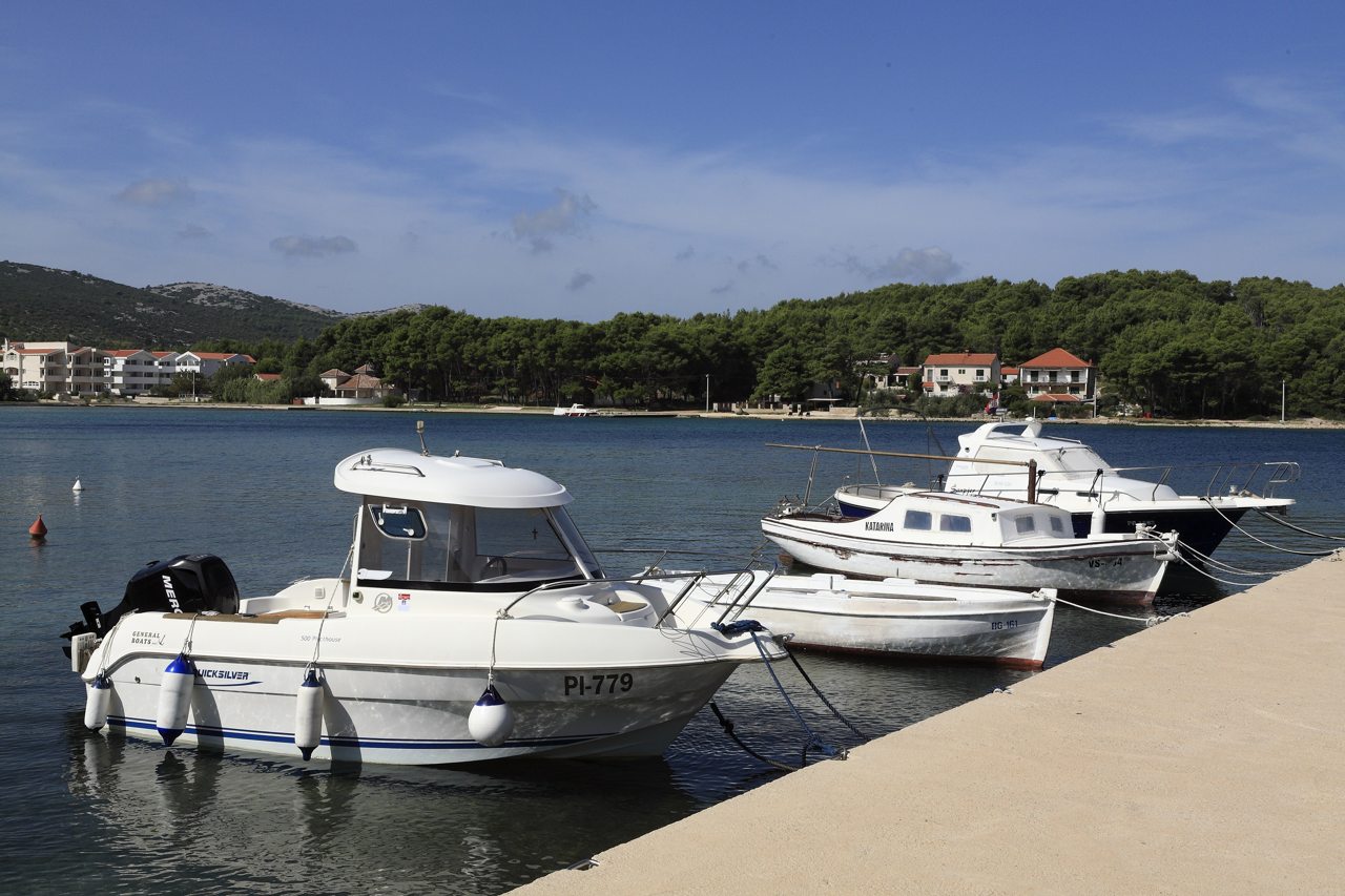
Pašman village sits near the middle of the island, facing the mainland across the Pašman Channel. Its harbour, bathing shores and the nearby islets of Babac, Komornik and Muntan give a boat outing an immediately varied setting. Lučina adds a sheltered-looking waterfront scene to the village’s appeal, although a photograph cannot establish the conditions for your arrival.
Agree the actual boarding point with the owner and arrange any visitor berth locally. A pickup named Pašman does not reserve space at a village quay. Leave time to enjoy the waterfront and choose one stretch of coast, rather than treating every bay on the island as part of the same afternoon.
Harbours, channel scenery and outer-coast bays
These are separate outing ideas, not a fixed route. The southwestern bays need their own passage and return plan; they are not automatic extensions to every short channel-side rental.
Tkon: a working ferry waterfront
Tkon links the island with Biograd by ferry and provides a lively harbour setting for a boat day. Watch the ferry’s arrival and departure space and confirm the exact handover or landing point. The working ferry facilities and local boat berths are not interchangeable with an allocated visitor berth.
The Pašman Channel: villages and islets
The island-studded channel offers an appealing alternative to a longer outer-coast passage. A day can centre on coastal views, a lawful swimming stop and a pre-arranged waterfront meal. Use current charts for the passages between islets and keep clear of the regulated Pašman Strait traffic lanes; crossings require particular attention.
Soline: a bay with managed moorings
Southwestern Soline is one of Pašman’s established nautical destinations. The tourist board identifies managed anchorage areas here, while the regional nautical guide describes buoy moorings and a shore with houses and small piers. Confirm current allocation and conditions with the operator. This is the southwestern bay, distinct from the Soline bathing place at Ždrelac.
Lanđin: an outer-island outlook
Lanđin combines an indented island shore with views towards small offshore islands. It is another recognised managed anchorage in the Pašman tourist-board brochure. A mooring stop can become the focus of an outing rather than a rushed detour. Request permission and a suitable allocation instead of treating an empty buoy as freely available.
Žinčena: a quieter bay to consider
The regional nautical guide includes Žinčena among the southwestern bays visited by boaters. Its attraction is the change from the channel’s village waterfronts to a less developed coastal setting. Check the current stopping arrangements and weather suitability locally; a cove description does not establish an unrestricted anchoring area or a right to use a private pier.
Mali Ždrelac: a passage to assess first
The bridge passage between Pašman and Ugljan needs proper planning, including checking mast air draft against current bridge-clearance information. Article 57 of Croatia’s navigation rules sets an 8-knot maximum, with priority for vessels entering from the northeast, subject to scheduled passenger-ship priority. Craft up to 15 metres must not impede larger vessels. Sailing, anchoring, stopping and fishing are prohibited in the passage and immediately before its entrance and exit. Use current charts and local traffic instructions; do not assume a yacht can pass beneath the bridge.
Wind exposure and stopping decisions
The channel shore and southwestern bays face different stretches of water. Check DHMZ’s marine forecast, gusts and wave direction for the intended coast and the return. Bora and southerly weather can change the suitability of an outing; a calm departure harbour or a buoy in a bay does not guarantee protection for the whole day.
- Respect mooring restrictions. Follow charted and harbour-authority anchoring prohibitions, bathing-area clearances and cable restrictions. Shore lines must not obstruct navigation or damage vegetation. Obtain permission before using a managed buoy or pier.
- Keep the outing realistic. Agree the permitted operating area, skipper arrangements, fuel margin and return conditions with the owner. Confirm current services and availability before committing to an outer-coast stop.
Sources and photo credit
Original nautical guide researched on 2 November 2026. Check current weather, official navigation information and local mooring arrangements before departure.
- Pašman Tourist Board: Pašman village and its island setting
- Zadar County Tourist Board: Pašman and Tkon
- Pašman Tourist Board brochure: channel and Soline/Lanđin anchorage areas
- Zadar region nautical guide: southwestern Pašman bays
- Pašman Tourist Board: Ždrelac–Soline bathing shore
- NN 52/2025: Articles 53, 57 and 64, anchoring, Mali Ždrelac and Pašman Strait traffic
- DHMZ marine forecast
Photo credit: “I10 489 Pašman, uvala Lučina” by Falk2, 26 September 2012, Wikimedia Commons, CC BY-SA 4.0. Resized to 1280 × 853 pixels and JPEG recompressed; no crop or other image changes. The historical photograph illustrates the waterfront, not current berth arrangements.
